Image Planner Application for Mapping of Agricultural Areas
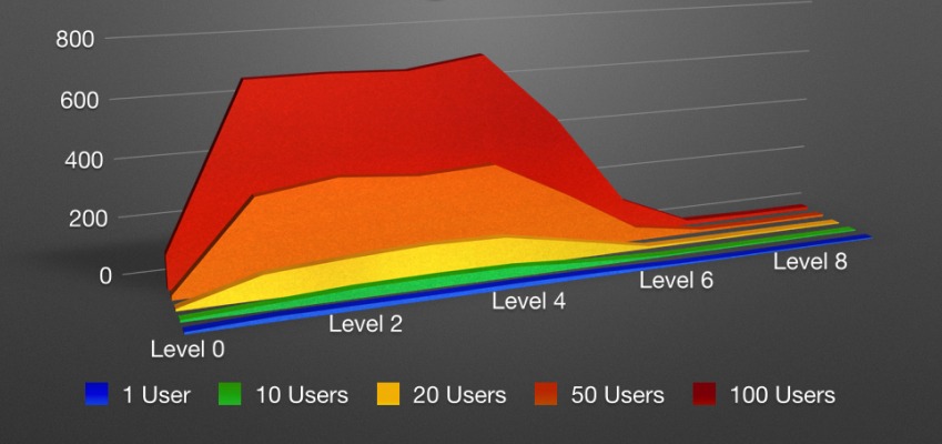
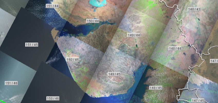
Introduction and Need For Image Planning Initially we had planned to map the Agricultural areas of Gujarat and the major problem faced by us was to find the images...
Introduction During the initial testing phase of our developed Web application, there arose a need for Web server benchmarking. Since the performance results of the system to be deployed...
Introduction The easiest way to print a representation of geographical data from QGIS is to use the “Save As Image” which will create the picture of the data layers...
Introduction Atlas is a collection of maps which depicts similar thematic concepts of different area and regions. Let’s say the field team is ready with GPS coordinates of the...
Introduction In an earlier blog of QGIS Map Composer, we have explored the basic map elements and procedures to create them using print composer tool. A professional map which...